

How Technology is Transforming Land Surveying
Land surveying is no longer just about measuring land with traditional tools—it has evolved into a high-tech profession that relies on cutting-edge equipment and software. Surveyors today use GPS, drones, 3D modeling, and GIS mapping to collect, analyze, and present data with unprecedented accuracy.
If you enjoy working with technology, problem-solving, and data visualization, a career in land surveying provides plenty of opportunities to work with advanced tools.
What Technology Do Land Surveyors Use?
Modern surveying blends fieldwork with technology, making it an exciting and innovative career. Some of the key tools surveyors use include:
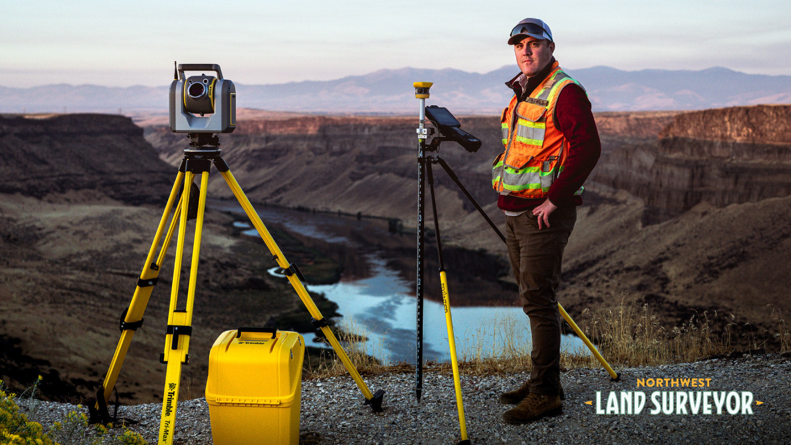
1. GPS & GNSS (Global Navigation Satellite Systems)
- Uses satellite technology to collect precise location data.
- Reduces human error and speeds up data collection.
- Essential for boundary surveys, construction projects, and large-scale mapping.
2. Drones & Photogrammetry
- Captures high-resolution aerial images for mapping and terrain analysis.
- Helps surveyors collect data from hard-to-reach areas like mountains, forests, or large construction sites.
- Improves safety and efficiency by reducing time spent on-site.
3. Total Stations & Laser Scanners
- Measures distances and angles with high accuracy.
- Uses laser technology to create 3D models of terrain, buildings, and infrastructure.
- Commonly used in construction, engineering, and boundary surveys.
Many outdoor careers that pay well involve technology, but land surveying stands out for its mix of hands-on work and advanced tools.
4. AutoCAD & GIS Software
- AutoCAD allows surveyors to draft and design highly detailed maps and plans.
- GIS (Geographic Information Systems) helps analyze spatial data for land development, zoning, and environmental impact studies.
- Essential for surveyors working on urban planning, real estate development, and government projects.
For those who prefer **working with technology over fieldwork**, roles such as GIS analysts and AutoCAD drafters provide strong career paths. Learn more about field vs. office work in our guide: Do I Have to Work in the Field as a Land Surveyor?
How Does Technology Improve Land Surveying?
Technology isn’t just about new tools—it enhances efficiency, accuracy, and safety in land surveying. Here’s how:
- Faster Data Collection – GPS, drones, and total stations speed up surveys, reducing time spent on-site.
- Higher Accuracy – Advanced instruments eliminate human errors, ensuring legal boundary precision.
- Better Visualization – 3D models and GIS mapping provide detailed representations of land, infrastructure, and city planning.
- Increased Safety – Drones and LiDAR allow surveyors to work in hazardous areas without risk.
As a result, surveyors can complete projects more efficiently and with greater precision than ever before.
Is Land Surveying a Good Career for Tech Enthusiasts?
Yes! If you enjoy working with technology, problem-solving, and data analysis, land surveying is a career that allows you to:
- Use high-tech equipment daily, from drones to GIS software.
- Work on diverse projects, including real estate, construction, and environmental conservation.
- Be part of an industry that is constantly evolving with new innovations.
Surveying also attracts professionals looking for a **career switch** from industries like construction, engineering, and GIS. Read more: Is It Too Late to Become a Land Surveyor?
Start Your Career in Land Surveying
If you’re looking for a career that combines technology, problem-solving, and hands-on work, land surveying is a great option.
To learn how to get started, check out:
For more information, connect with us here.